By Moses Asamoah
Considering the importance of water and how its sources may be affected by flooding, a BRECcIA team of researchers set out to assess the impact of flooding on water sources and livelihoods in the Upper East Region and Northern Region of the Republic of Ghana.
This was an assessment of flooding impact on water sources, livelihoods and community adaptation in the Northern drylands of Ghana caused by scheduled release of water from the Bagre Dam, Burkina Faso and seasonal torrential rainfall. This small research project (SRP) study specifically addresses a major problem and threats to water and food security raised by stakeholders at the BRECcIA Tamale workshop in Ghana, where dam water releases, typically occurring in August-October after heavy rainfall, have caused fatalities, damage to crops, water sources and property in Ghana.
Field data collection
Field data collection is that stage of research or a study when the researcher will leave their office, pick up audio and visual recorders and other gadgets, pens and field notebook, and other prepared tools to go and experience, observe, participate and gather information of interest on the subject under study in an outdoor setting. If the study is a human subject, then an ethical clearance and consent needs to be sorted before engaging the participants or respondents.
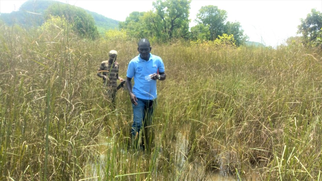
The team made a 13-hour road trip (1-day) journey from Accra (southern Ghana) to Bolgatanga (Northern Ghana) during the flooding peak to collect some samples of the affected water sources for laboratory analysis and also to interact with community members and key informants to ascertain the impacts and coping/adaptation measures they employ to lessen the impact of the flooding on their livelihoods.
Field experience
Very near may be relative depending on the setting.
How pleasing and nice “very near, just close by and you are almost there” sounds when asking for directions in the field, especially when you have walked far and are exhausted. I remember very well in the field during water source sampling when a community member pointed his finger in a specific direction and said the borehole is just nearby and we are almost there, but we ended up walking for almost one and half miles in our wellington boots through a marshy and swampy route known to be a shortcut. It was an experience no one would like to go through after several hours of walking and holding an ice chest filled with collected water samples and ice blocks.
End of road
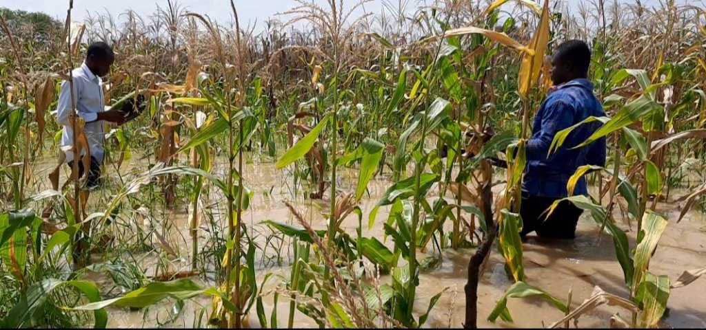
Flooded areas can be very tricky, especially in a gently sloping area. Another notable experience was when we decided to collect a water sample from an inundated area of the community. The water level increased with every step towards the sampling point. It got to a point where we had to abandon that water source because the road to the water source had ended for us (inaccessible). This decision was taken when the flooded water level reached our waists. The passion and vim for this study urged us to go further but upon second thought, we realized our body might be submerged by the time we get to the water point and cannot even take the sample.
Stuck in the mud
This field data collection changed my mind on the perceived truth of the ‘unstuckable’ nature of 4 X 4 wheel drives as I see in the adverts. At one point a Nissan Patrol and a Mitsubishi Pajero – both 4 X 4-wheel drive – got stuck in terrible mud. It took the help of a caterpillar on a construction site to pull us out of the “gargantuan mud” as it was described.
Community Participation
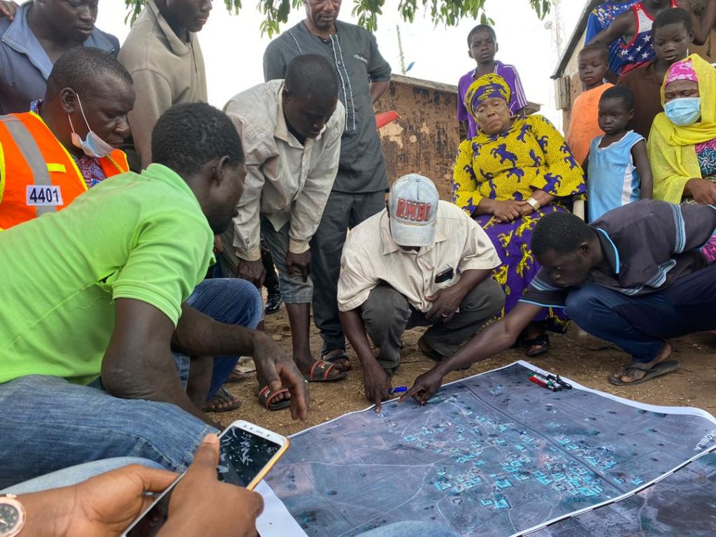
During a community’s participatory mapping, a 3D community satellite image printed on polypropylene at A0 size was given to community members to identify flooding affected areas over the past years. The most severely affected areas were pointed out, including this year’s as well as water source points, sanitation and healthcare facilities. It was a fantastic experience seeing how participants were disagreeing with each other as to what is where on the image. At one point everybody wanted to hold the marker because they felt they were more knowledgeable with locations of sites in the community than the assembly member (community representative at the government level). We anticipated to engage with a few people but ended up receiving a whole crowd. Both men and women were duly represented. By the end of the process, a nice and perfect job was done by the community members.
Community entry meeting with the chief, elders, research team and some dignitaries from the local government sector provided an opportunity for the community leadership to express their joy for such a study to be carried out in their community. They shared how important and relevant this study was to their communities, especially those most impacted by annual flooding events. The community members provided all the needed assistance and actively participated in the data collection.
Fears and risk taking
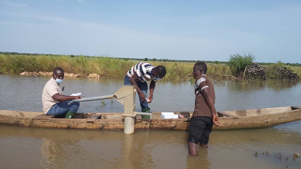
Most of the inundated areas were only accessible with the help of a canoe. I remember very well during one of our water sample collections in a community whilst on a canoe, where we passed under a tree and one of the community members commented “sometimes your canoe will pass under a tree and a reptile (snakes and even scorpions) will fall into your canoe from the tree because they also take shelter on the tree when the area is flooded”. I asked him whether dead or alive? He answered, “very much alive and hungry because it has been there for somedays without food.”. I further asked, what happens then? He replied, “the fittest survive in the canoe or those who can swim faster”. At that moment, my heart skipped a beat. Some also made comments while on the field, such as “this area is the home to snakes and scorpions especially during this raining season. Some of the snakes are even brought home by the flood.”. At the end of the process, we were able to collect our samples successfully without anyone getting hurt even though some snakes were sighted from afar.
Sad moments
The impact of flooding on livelihoods are mostly unbearable and devastating. Upon reaching a community it was realized how bad people’s lives have been affected, seeing such things as collapsed buildings, food stuffs lost or carried away by the floods. People were looking up to us to at least give them some kind of relief materials or money to buy some food. Unfortunately, as researchers there was not much we could do. When you see some of their water sources, one can tell by simple observation with the eye to conclude that they have been contaminated. Some people look up to you for some disinfectant for immediate treatment of the contaminated water source, but due to the tight budget we were working with we could not assist as much as we wanted.
We learnt a lot from the data we collected, but more importantly, we had the opportunity to witness at first hand the plight of the people. We recommend that researchers should include some form of contingencies in their budget to cater for some simple immediate relief when encountered on the field, like providing materials for disinfecting water (chlorination).
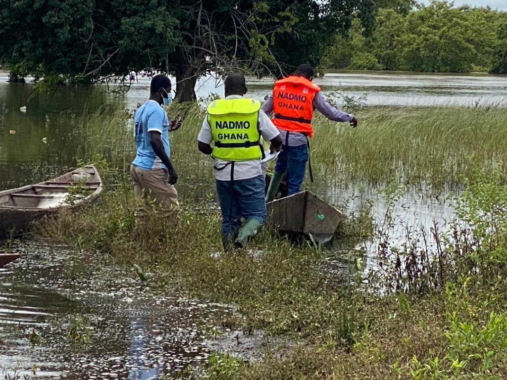
Canoeing remains the only travel option in heavily flooded communities 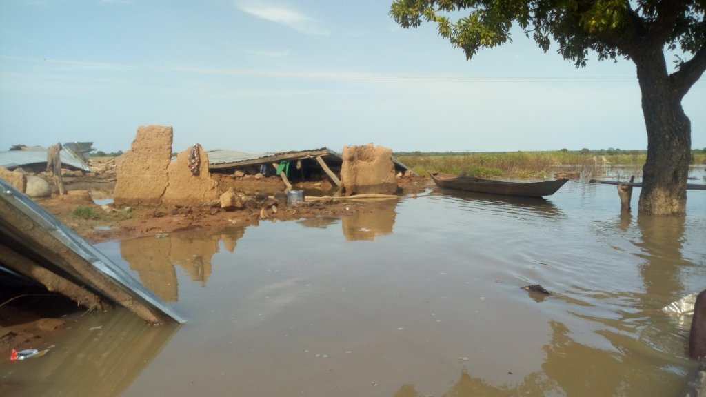
Buildings fall victim to the flooding