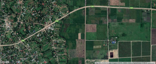
To ensure food security, we must first understandwhere the food grows, how the agricultural land area changes and why these changes happen. This information and understanding is scarce in sub-Saharan Africa.
Thisproject therefore aims to monitor spatial and temporal changes in agricultural land area in relation to land use and land cover change.By using high spatial resolution satellite images we will develop an algorithm for classifying agricultural area and land use types. We will monitor changes in agricultural areas at country scale in Malawi, Ghana, and Kenya with a spatial resolution of 30 m.
This research will generate agricultural extent maps, which are thefirst step in evaluating food production and to improving agricultural productivity.This research will also detect agricultural areas undergoing rapid changes and potentially explore the factors responsible for these changes, which possibly will be delivered to policy makers and provide guidance on areas where attention is needed. The research output will also help to understand how the specific policies affect changes in agricultural area and eventually food security in Sub-Saharan Africa.
Team members:
Chengxiu Li (University of Southampton, UK)
Fiona Ngarachu (Kenyatta University, Kenya)
Matt Kandel (University of Southampton, UK)
Mathews Tsirizeni (LEAD-SEA, Malawi)
Jadu Dash (University of Southampton, UK)
Samuel Codjoe (University of Ghana)
Chris Shisanya (Kenyatta University, Kenya)
